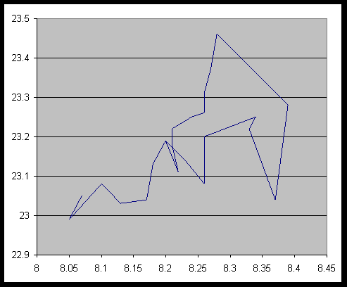

A graph of minutes north latitude and minutes west longitude of the path followed in collecting magnetometer readings (see graph 2). To convert to actual latitude and longitude add in 66° degrees north latitude and 151° west longitude. The actual path on the ground was fairly close to straight (especially for the first 5 readings which were on the lake) and started from the left, went to the NNE (up and right on the graph). On the return leg we started from a point to the east of where we stopped (down and right on the graph) and went back to the lake shore. Although this data seems to indicate that we tied back in with the outbound traverse at point 7, this was actually point 8. The trace of the GPS readings fails to follow a straight line because of errors in the readings.
The current copyright laws protect this page, even though not specifically copyrighted.
However if you want to use portions of it feel free to do so, though I would appreciate it if you would acknowledge my authorship.
First written Spring 1999