First thing in the morning I hiked up to the harbormaster’s office to confirm my slip and register. While there I asked about a place to buy Canadian Charts. The guy in line behind me piped up and said he had some he didn’t need any more. So he ran home and got them and I got 14 charts for $100, or about half price. Then he gave me a ride down to the store so I could pick up the rest I needed (which cost another $155—and left me still needing a few more). I hiked the mile back to the boat, took my laundry to the Laundromat and after the laundry ($4—but didn’t get it very clean) I spent an hour getting this log caught up and in the computer. Then I loaded it on the zip drive and went to the internet café (Frantic Fran’s), which was about half a mile from the boat. They didn’t have a zip drive so I hooked up my drive to their computer, downloaded the appropriate software and managed to get the logbook uploaded. I sent it to Frankie so she could get it put on the website. Though I was there almost an hour they only charged me $3 since I was using a lot of my own equipment, which was mighty nice of her.
The only food I needed before getting to Washington was bread so I hiked to the store and bought a loaf—which cost $2! Then Burger King for dinner ($7) and back to the boat ro read for a couple hours. About 2100 the boat next to me left, so I took advantage of the empty slip and turned the boat around. Now I can work on the motor from the dock. Then I read by candle until bedtime.
There were gales and storm force winds forecast in the Gulf and Dixon entrance, so I stayed put until it settled down. I bought a few books and did a lot of reading, played on the internet at the internet cafe, and spent a day working on my web site. I also went to a couple of movies and explored Ketchikan a little better. I overhauled the motor, changed the oil but did not manage to find what was wrong with the starter. I didn’t want to take the choke apart without pulling the motor off, so didn’t mess with that.
I got hooked on a good book and read until 3 am. So I slept in until 0830, instead of getting up at 0700 like I’d planned. I walked down to the internet café and checked the weather. It looked like the storm was pretty well past, leaving showers. By the time I’d gotten water, paid the harbor master, called Frankie and had breakfast it was nearly noon. The engine started right up and I motored to the fuel dock. There was a long line there and it took almost an hour by the time I’d gotten fuel, so it was 1300 by the time I left Ketchikan.
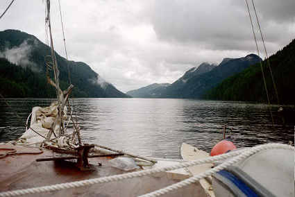
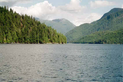
The tide was running against me through the rest of the Narrows and when I got out in Revillagigedo Strait there was a 12 knot headwind. As I got farther down the strait I also found some ocean waves, which further slowed me down—as slow as 2 knots. So it was very slow going and I stopped at 1730 about 10 miles before I’d planned. I would have gone a little further, but there weren’t any other good places to stop. As far as that goes, this place isn’t very good; though Custom’s Cove is well protected from the south wind that is blowing, it is completely open from the NE to NW, so I hope the wind doesn’t change. I anchored about high tide, and was glad I hadn’t tried to actually go very far into the cove, for as it went out a lot of rocks were exposed. I ran the generator for awhile, providing a little heat and light.
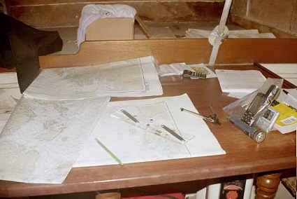
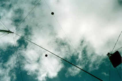
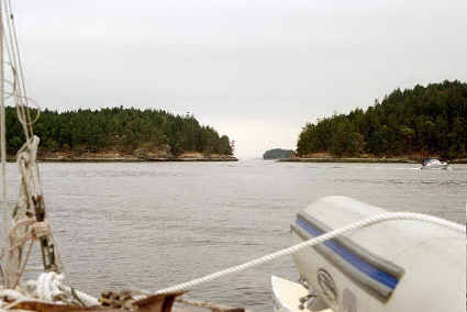
I was up early for I had a chance to make the 65 miles or so Prince Rupert, and by 0630 I was under way. The SE wind was still blowing so I went around the east end of Mary Island and then through Dangerous Passage, which was tricky due to lots of rocks, so I did slow and careful. When I was clear of the passage I put up the sails and made several long tacks getting down to Dixon Entrance. There the wind was a direct headwind so I doused the sails and motored-very slowly-out across the entrance. It was 2 pm by the time I was off Lord Rock, just north of the Canadian border. It was looking very doubtful about making Prince Rupert, with less than 7 hours of light left and 35 miles left to go. During the afternoon I took a photo of charting and navigation in Dixon Entrance.
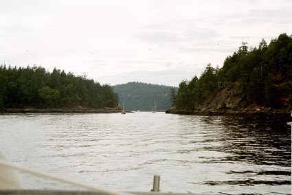
Then the wind changed to the eastward, I turned more southward, and up went the sails. Up went my speed-from 3 or 4 to 6 or 7. Then the wind increased even more, to as much as 20. I had all the sails up and my speed peaked out at 8-9 knots (by the GPS). This held for several hours, and by the time it was dropping away I was off the narrow shortcut that led to Prince Rupert. The Sailing Directions advised local people only, but it looked well buoyed, so I decided to attempt it (there was no other way to make Prince Rupert that night). The passage was a neat little channel that twisted and turned and it got darker and darker as I wound through it. Then I exited the passage and shortly I was across seeking a place to tie up at their docks.
After getting tied to their dock I hiked up to
call
customs. They said to get the
documents
and call back, they could do it all by phone.
So I went back to the boat and got the numbers they wanted,
and
then
cleared their customs by phone:
After that I called Frankie (she was pretty surprised I’d made it there so fast!) and then went back to the boat for a quick dinner and a bit of reading before bed.
Though I didn’t sleep very well because of the 10-15 mph wind bouncing the boat against the dock, I was up early and by 0745 (0645 by my old time—I’d crossed the time zone yesterday) I was under way. When I’d cleared the point I picked up just enough wind to make it worth putting up the jib and mizzen. The sailboat half a mile ahead of me (who’d passed me earlier) saw my sails go up and put his up as well. Shortly after that the red boat I’d seen leave Ketchikan passed me, motoring along at a good rate.
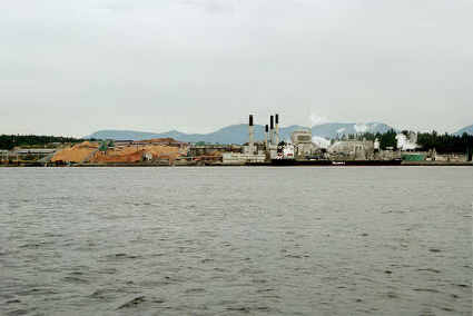
It showered off and on most of the morning. Unfortunately the wind only lasted a couple of hours, and down came the sails. Photo 16, birds by the hundreds in Arthur passage. I wound my way among the islands just south of Prince Rupert, and by noon I’d gotten to the Grenville Channel. Photo 17, Tumbleweed sailboat and entrance to Grenville Narrows. They are about as wide as the Yukon River (by the bridge), and 45 miles long. My timing was good, for the tide was flooding into them, and gave me a nice boost as I motored down them.
Shortly after entering the narrows I saw, about 5 miles ahead, an odd sight that I had to get closer to before I could figure it out. It had looked like a kite, fluttering back and forth over the edge of the Narrows. Turned out to be a helicopter hauling logs from the ridge to the water--photos 18 & 19.
Photo 20, about midway down Grenville Narrows. Photo 21 waterfall dropping into Grenville Narrows. I got a little more than halfway down the narrows by early evening. I would have gone further, but there wasn’t any place else to stop so I pulled into Lowe Inlet and motored back into the cove and anchored. The red sailboat was anchored there too, as well as two other boats. Still didn’t manage to get close enough to the red boat to see what her name was!
There are very few places (only 3) to stop along the narrows. Consequently there were 8 of us anchored in this smallish cove by dark. I spent an hour or so doing chores (dishes, cleaned up the cabin a bit, sorting charts) and then spent the rest of the evening reading. This cove is a nice place, and if I had more time I’d stay a day and explore.
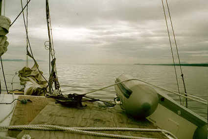
I was up early, and as the light morning mist lifted I got under way. Photo 22 rockslide in Lowe Inlet. I motored slowly out of the Inlet (for which I did not have a good map), so if I found a rock the hard way I wouldn’t do much damage. Photo 23: Grenville Channel, looking N with Lowe Inlet on the right (which may be hard to see). Once back in the Grenville Narrows I found a trailing tide which pushed me nicely southward, making the remaining distance in the narrows go by fairly fast. By noon I was clearing the narrows. As I motored across the sound to Princess Royal Channel, I saw a few whales. The wind started blowing a tiny bit from the west, so I put up the sails. I managed to sail until several miles inside Princess Royal Channel, when a twist of the channel turned it into a headwind. Photo 24 waterfall draining Whalen Lake into Princess Royal Channel. Photo #1 just south of the waterfall, a rock “slide”. Photo #2 old falling in (hotel?) building at the waterfall from Butedale Lake. Looked like a neat place to explore. #3 Khutze Inlet. #4 waterfall and cliffs across from cove. I made it down the length of Princess Royal Channel and into Tolmie Channel. By late evening I needed a place to stop, and found it in a small cove about a mile up a larger cove across from Sarah Island. #5 waterfall on west shore of Sarah Island. I motored into the cove and dropped anchor, planning on using the momentum of the boat to set the anchor. Only 25 feet of line went out at first, but it must have landed on a ledge because when I snubbed the rope the water went from 25 feet deep to 50 feet deep with the rope hanging straight down! So I moved a little further into the cove and re-anchored in about 40 feet of water, with all 250 feet of rope out.
I had a good night, and got up early enough to get under way by 0730. Shortly after getting going it started to rain. I proceeded down the last bit of Tolmie Channel, went the short length of Sarah Passage and out into Finlayson Channel. By early afternoon I was across Milbanke Sound, which, though exposed to the ocean, had only minor swells. Seaforth Channel, my next body of water, was a problem only in that I couldn’t find a map for it. Finally had to just stop and go through every chart! Turned out I’d written down the wrong chart #…so I was looking for the wrong (non-existent) chart.
From Seaforth I turned south into Lama Passage and, by 1600 I was tied up in Bella Bella. I had hoped to buy charts, but there wasn’t a store that had them, so I called Frankie. She (as expected) wasn’t in, so I left a message and by 1630 I was on my way again.
Just after leaving Bella Bella I started the beans cooking for dinner—oh, what scrumptious smells to tantalize me with as I motored on south! The cabin was nice and warm too, from the cooking—which was real nice because the rain had continued. By 1830 I decided to call it a day and stopped in Long Point Cove. Another boat was there when I arrived and one followed me in, and by dark 2 more had anchored in this small place! I spent the evening with the generator on, charging the starter battery (it has been a very long time since I’ve done that), with lights and electric heat.
I spent the early evening sorting charts and working on the logbook, while the beans finished cooking. I’d planned to add onion, but (most unfortunately) the last of them had gone bad. I think they would have kept, except I’d left them in the plastic bag I’d bought them in and they’d rotted.
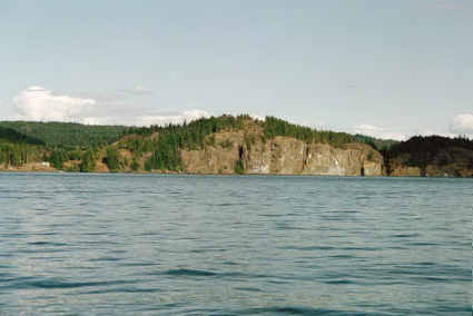
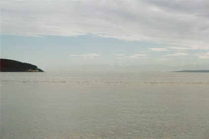
I had wanted to get all the way across Queen Charlotte Sound, but it was a very long way (70 miles to the nearest place I could stop on the other side, which was on the N side of Queen Charlotte Strait). So I was up before it got light and by 0615 I was pulling the anchor up. Even before I got out of the cove it was starting to rain. More bad news when I got out into the strait: headwind. The waves kicked up by the wind were soon big enough so the motor was occasionally picked out of the water. As usual when that happened I very nearly came to a dead stop. So when the shoreline veered W I followed it, seeking some protection from the wind and waves. Which was limited for a long time. Since I was only doing 3-4 knots I began considering alternative harbors along Fitz Hugh sound, well north of where I’d intended. When I got down to Calvert Island the shoreline was trending SSE, and the wind was down a bit. Between the two I picked up some speed. By the time I’d cleared Calvert Island (out into Queen Charlotte Sound) at 1300 the wind had shifted to SW and dropped to 7. I decided to try the sails and put them all up. I couldn’t quite point south to where I wanted to go, but it was close enough. Then the wind quit entirely. I considered taking down the sails but I could see dark water off on the western horizon, which I hoped was more wind so I decided to give it half an hour. Sure enough I soon had a little more wind, and, with the motor, was managing 7 knots. The wind was from a better direction too- WSW. The rain had started letting up about the time I got to Calvert Island, and when I entered Queen Charlotte Sound the sun actually came out and it turned into a gorgeous day. The swells, though six feet, were gentle moving slopes. I was going across them and hardly noticed as they rolled by, one after another. This crossing, which I’d heard horror tales of, was turning into a cake walk!
Since I was now going so much faster than before I began to look for a place to stay all the way across—on Vancouver Island! Port Alexander looked like a good harbor, so I carefully measured off how far it was and calculated I could make it half an hour before dark—giving me a 75 mile day…when I though I’d be luck to make 40! [photos]
Port Alexander was just as I’d hoped, well sheltered from the SW wind (though it would be a bad place in a SE blow). The large bay only had one other boat when I arrived at 2030. I dropped anchor, read for a little bit and went to bed.
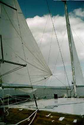
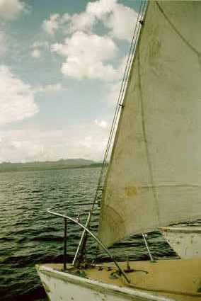
Photos 10-13: under full sail.
Although I was up before 0700 it was 0900 by the time I was under way for I needed to dump out the 15 gallon “fuel” tank to get out any accumulated water (the preveous day, when I’d dumped more gas into the nearly empty tank, it had stirred up the water enough to get sucked into the fuel filter, causing the engine to quit!) Then I pumped gas from the drums into the tank and the 5 gallon cans. (I had been siphoning it, but the drums were getting too low for that.)
Port Alexander looked like a fun place to explore, and it would be nice to come back sometime. It is large enough place so a lot of boats could anchor, though only 2 more had shown up overnight (total anchored there was 4, including me).
Leaving the bay behind I headed down Goletas Channel, and across the southern edge of Queen Charlotte Strait and into Broughton Strait—basically along the coast of Vancouver Island. It was calm to Queen Charlotte Strait and then a 5-8 mph N breeze picked up. I set all the sails, which probably added 1-2 knots to my speed. The wind kept up for about 3 hours and then shifted E and died down so I had to take them down again. I was passing a number of towns, so I tried the AM radio, which worked just fine. Probably have good signals all the rest of the way to Seattle [I did.] Photo #14 Port McNeil.
While I had complete small scale maps I had been unable to buy all the large scale charts I’d wanted, and there hadn’t been any for sale in Bella Bella. So there were a couple of gaps in my coverage. By 1700 I was at the edge of one of those gaps. The last bay on the large scale chart was Boat Bay, so I pulled in there for the night.
It was a fairly well protected anchorage, though there was quite a bit of kelp around. An hour after I anchored a couple of kayakers stopped by and we chatted for awhile. After dinner I did the dishes and spent the evening reading.
Photo 15: sunrise over Johnstone Strait; #16 eddy in Race Passage; #17 Acrux under powerlines. #18 Race Point and house perched on it; #19-21 Seymore Narrows; #22 Copper Cliffs; 23-24 Quathiaski Cove, where I spent the night.
It was critical that I get to Seymore Narrows right around the time the tide changed, for there was a very strong current running through there. So I was up before it was light, and as it began to get light I was hoisting anchor and getting under way. By 0540 I was feeling my way out of Boat Bay. I went out between the island and the rock (the way I came in), going very slowly for it was still to dark to see into the water. But I made it ok, and was headed on down Johnstone Strait into the brisk morning with wisps of fog decorating the hills.
The going was very slow because I was fighting the tide. By 10 am I’d only made 16 nautical miles, and I was starting to think I’d not make Seymore Narrows (40 miles away) by 1530 goal. Then the tide changed and I began to pick up speed. Then I entered Race Passage and I really speeded up. It was like running down a river! Curious as to my speed I turned on the GPS: 9 knots! That speed didn’t last long, but I did average 7 for most of the rest of the way to the Narrows.
The wind did not help at all. It blew from the east, a direct headwind, at up to 5-10. Then, when I round the NE corner of Vancouver Island and headed south to the Narrows the wind turned south at 5!
As I was getting close to the narrows I could see a barge waiting for the current to slacken. About half an hour before I would arrive the barge headed through. I was a little concerned because I didn’t know the exact time of high tide, and didn’t want to have to wait six hours for the next slack tide. But when I got to the narrows (at 1510!) the tide was still flowing south, so I got a nice shove—but not too much either, since it was very close to high tide. It didn’t take very long to traverse the 2 miles down the narrows. At the south end there were some powerlines—fortunately 53 meters (over 160 feet) off the water so there was no problem going under them.
Again I was nearing the edge of my good map so I stopped at the last cove on my large scale map: Quathiaski Cove. It was only 1700, but having started before 0600 it was a good time to quit anyhow! It turned out to be a very poor place to anchor, for it was exposed to the channel where a lot of boats were going by, and it was 2300 by the time it quieted down.
There were houses all along the shore, which made me feel like I was camped in people’s front lawn! Around dusk, when I was lighting the anchor light, someone called down to warn me there was going to be a loud noise! Sure enough, 15 minutes later there was a loud bang. Fireworks, I think.
Photo 1: the town of Campbell River; #2 down the Strait of Georgia #3 E. Vancouver Island Coast
Today turned out to be a pretty long and boring day. I got underway by 0800, and by 0830 I was out in the Strait of Georgia, which is a fairly large body of water between Vancouver Island and the mainland. For the most part the day was calm, and there was essentially no current so the boat could be left steering herself for a few minutes. This allowed me to putter around, doing odd jobs like cleaning the mud off the front, pumping out the outriggers and properly stowing the sails. By late evening I was pretty far down the Strait, and headed for what looked like a good place to spend the night. Ug; to crowded. So I headed on down the coast a bit further and, since it was a very quiet night, anchored in a small indentation in the shore. Million dollar homes were all around, but it was almost dark when I anchored so hopefully I didn’t disturb anyone!
Photo #4 Destination Bay; #5 Designation Bay Sawmill; #6-(before) #7 (after) Dodd Narrows; #8 looking west down Trimcomali Channel (behind me); #9 Olympic Mountains, San Juan Island to the left, Vancouver Island to the right.
I had a long way to go to reach Friday Harbor so I was up early and as soon as it was light enough slowly proceeded from the little cove where I’d spent the night. The morning was mostly overcast but, with the exception of a couple small showers, improved as the day went on and I proceeded southward. I exited from the Strait of Georgia a couple hours after getting going, and went down through Dodd Narrows—which I fortunately hit just before slack tide so getting through them wasn’t a problem. The narrows are very narrow; not a route for big boats, but I made it through fine. There was a 3 knott tide flowing against me, so I was glad they were short. This put me in Trimcomali Channel, which I followed until early afternoon.
I had been a little concerned with my fuel, calculating that I’d have 1-2 gallons left when I arrived in Friday Harbor. This turned out to be a moot problem, for after the Dodd Narrows the tides turned in my favor and pushed me right along…saving an extra gallon of fuel. (Note: even if I’d had less fuel it wouldn’t have been a problem—there were plenty of places to get it!)
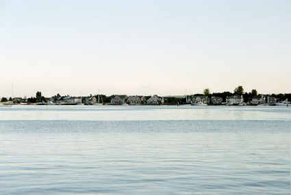
It turned sunny with a SW wind when I exited Trimcomali Channel so I put up the sails. It only lasted a couple hours, but every bit helps! Not to long after putting up the sails I crossed the border back into the US. I arrived in Friday Harbor at 1730. I radioed the harbormaster (after seeing a sign telling what frequency to use!) about clearing customs, and they directed me to the outside of the south (floating) breakwater which was red and had “customs” painted on it. I tied up and went up the hill. Since it was after customs normal 5 pm closing I had to call the 800 number. They directed me to the office, which was locked. But a moment later a guy showed up who was to meet them at 1800. So we waited together. A few minutes later the customs agent arrived and we were processed through. I had to get a $25 sticker for the boat and was given a clearance number. By the time everything was all done it was after 1900. I moved the boat to the outside of the north breakwater, which wasn’t too bad a spot—especially after it got late and people quit going by so fast.
Right on time, Ev knocked on the side of the boat at 0530. I got up and invited him aboard and we chatted for about 20 minutes. Then I walked with him up to the ferry dock, where his car was waiting in line to get on the ferry. Shortly after we got there the ferry finished unloading and he had to leave. I walked around a bit, bought and read the newspaper (strange to have a complete news update after a month without!). By that time the harbor office was open so I went and paid my bill (over $60 for 2 nights). While there I enquired about a laundry, chart store etc. Then it was back to the boat for breakfast.
After eating I went to the chart store and got Seattle area charts and also bought Voyaging on a Small Income by Annie Hill. On the way back to the boat I stopped in the park and read until lunch time. After lunch I went up the road to the laundry (pretty expensive; $3.50 to wash and $2 to dry). As soon as my laundry was started I headed to the internet café, but got badly sidetracked by a used book store. So I went to the internet café after finishing the laundry, catching up on my email until dinnertime. Whiule eating a guy stopped by the boat and was interested in it so I invited him aboard, and we chatted for a bit. Then I read until dark and then hiked up the hill for a peach (scrumptious) and a nectarine (divine).
On the way back down the hill I stopped and chatted with the blind lady (May) and her husband, whom I’d run into several times during the day. Back to the boat, quickly write this and then bed.
Photo 10 – first view of Seattle, #11 Seattle, #12 Miller Bay and Mt Rainer in the background (to faint to make out though).
I was up at 0600 to get ready for what was probably my last full day of sailing. I wasn’t sure how far I’d get, but it was only 57 miles to Seattle, so I’d anchor somewhere handy so I could get to the locks first thing in the morning. I hauled a load of garbage up the hill and then got the boat moved over to the fuel dock. I arrived just as he flipped over the Closed/Open sign. I spun the boat around (I’m getting more confident with my maneuvering skills!) and backed into the dock to make for an easy departure. After getting 27 gallons of fuel (enough to go to Seattle—and back)…at $2.30 per gallon…I hauled the porta-potti up the hill and dumped it. Then I threw away one of the old truck tires I’d had (carried to use as a drag in a storm), don’t really need two! Then I headed for Seattle.
I had a pretty good tide which helped push me down the last little bit of San Juan Channel and out through Middle Channel into the Strait of Juan de Fuca. The wind and waves were against the tide when I exited and the motion got a bit exciting for awhile. The 27’ boat behind me really got tossed around. It had just begun to settle down when I suffered the worst accident of the trip-a particularly nasty wave/whirlpool combination lurched the boat abruptly starboard. I had been sitting on the seat, reading and steering with my ropes. The sudden lurch dumped me to the floor of the cotpit (4’ down) and I jammed my wrist rather painfully—doubt anything is broken, but it remains (12 hours later) very painful to use. The wind, coming from the SW, had been adequate to put up all the sails but shortly after the wave it died down and I had to motor the rest of the way across the Strait of Juan de Fuca—my last large body of water!
By the time I was across and entering Admiralty Inlet it was early afternoon and the tide had changed so I had a nice push up the inlet. Although there was a certain amount of shipping, there wasn’t quite as much as I expected…maybe one big ship or barge every hour or so…and a lot fewer small boats than I’d seen up around Victoria BC! It was only 1610 when I got within about 5 miles of Seattle. I was tempted, but decided to anchor for the night. I chose Miller Bay, even though the Pilot Book suggested “local knowledge only”. I was glad I had, even though I (again) felt I was parked in people’s yard, for the wind rose in the early evening to 10-15. I’d only put a short anchor rode out (worried about getting it back with my bad wrist), but opted for more. I did the dishes after dinner, and (a very rare event) left the door open because it was such a nice (and warm) evening out. I read until 10 with the oil lamp.
Photo 13 Madison Bay; #14 Mt. Rainier; 15-24,
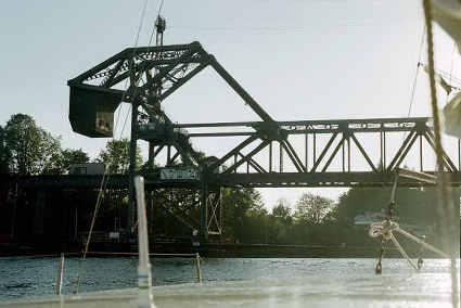
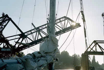
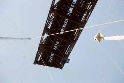
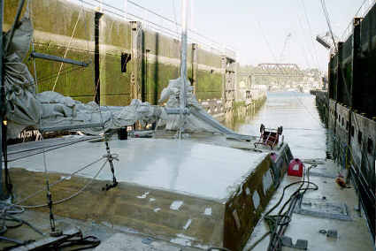
1-15: under
the bridge and through the locks:
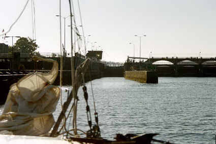
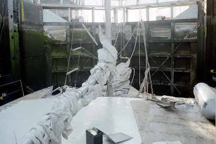
I was hoping to get to the locks before it got too busy, so I was up at 0530 and pulling in the anchor by 0600. One handed. Turned out not to be too big a problem, though I was glad the water was shallow!
Although my wrist was certainly a lot better, it still wasn’t up to working the sails, so even though I had a nice tail wind I left the sails off for the 8 miles across to the locks. I arrived around 0730 and had to wait for a bit for the train. While I was tied to the wall the lock people shouted down but I couldn’t understand them so I tried them on the radio. The promply answered, and wanted to know how wide I was. They also told me to try a long and short blast on my horn to get the drawbridge keeper to open (still no sign of a train). So I dug out the new horn, put it together, pumped it up and tooted at the drawbridge. Of course a minute after I did that the train came through. After the train was by the drawbridge promptly raised.
The wind was pressing me against the wall and I wanted to be sure to get far enough over so that I’d go through the open part of the bridge so I backed into the wind until I thought I could get turned and pointed without the wind taking charge. Turned out I was too conservative and had lots of room, but it is better than smacking something!
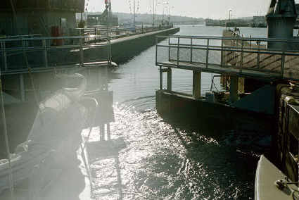
I proceeded into the small lock with only about a foot of clearance on either side. I was the first on in so the very helpful lock tender put me all the way in front, telling me where to tie up…even which bollard to tie to! A second boat joined me in the lock and then they closed the gat behind us and opened the valve. I was tied to a couple rising walls, so there were no complications of shortening ropes to deal with as the water raised the Acrux up the 8-10 feet to lake level.
Professional Marine Construction was right
beside
the locks
and by 0830 I was tied up, my voyage at an end.
Over
the next few days I’ll strip all my junk out of the boat and
stored in Spokane at the Nichols (Frankie’s parents).
Then I’ll leave it with PMC to be completely overhauled
this
winter, and fly home—to return next spring to a nearly new boat.
The overall trip was a great success; although
I
was ready
(and expecting) at least a few problems with the boat, the only
thing I
had
troubles with was the new engine! I certainly would
have
preferred
to take it a little slower and explore more of the places I went
charging by,
but that is for next summer. The time was pretty close to
what I
thought
it would take; it could have been a lot faster if I hadn't gotten
so
much bad
weather right after I left Valdez. The mistake I made in the
weather
predictions were because, I think, that the weather pattern
changed
from early
summer to late right about the time I left. Thus it took me
a
week longer
than it would have otherwise. Of course, if I'd had good
weather
right
then it likely would have made up for it later on.
The wind and waves I experienced when I got blown backwards were
educational. I learned the boat was still sturdy and could
take
it; I was
not concerned about it at all. I found that the waves,
though not
really
huge at 8-12 feet, were quite manageable and I think if I'd sailed
the
entire
way back to Prince William Sound it would have been a pretty easy
trip.
Even as it was it wasn't too difficult, though I had to steer
nearly
every minute.
There was less rain in SE Alaska than I expected, but I'm not sure
you
can draw
any conclusions about that because many people who live there were
commenting
on how unusually sunny it was. In general the wind was
lacking. I
did not manage to do any real sailing except for a couple of times
during the
entire trip.
Of the places I visited, Friday Harbor was probably the nicest
port. Many
of the anchorages were very nice, and I intend to stop and go
ashore in
many of
them next summer. After cruising around Prince William Sound
where you
usually have anchorages to yourself, it was educational to get
crowded
into
tiny anchorages with 8-15 other boats. The only places I
anchored
where
there wasn't anyone else were those which weren't real coves or
harbors.
The boat was not set up for anything more than just camping
out.
This meant
a chilly existence. The temperature was never more than 65
degrees
inside, and usually it was closer to 50.
Fortunately this type of living does not bother me.
There were a number of drips and leaks that
annoyed me (eg the one over the bed), but for the most part if I
was
careful I
could keep all my stuff dry by keeping it away from the places
that
were
dripping.
Evening lighting was probably the most important thing I lacked. I had a variety of options, none of which was very satisfactory. I used candles and the flashlight just about equally for reading in the evening. I did use the oil lamp for some reading and writing, but for the most part the light was inadequate for doing much.
In
conclusion I would say that the trip would have been
worth taking even if I hadn’t wanted to get the boat to Seattle. Next summer the boat will be a lot more
comfortable
to live on, with better power, heat and lights.
We
will see if this leads to a more enjoyable cruise.
Next Logbook: Shakedown
Cruise