THURSDAY, 7/24/03: ON TO
HINCHENBROOK ISLAND
* Barometer 1011.5
* Wind E to SE, 0-10
* Rain & fog to showers to rain
* 9-10
o C (48-50
o F)
* Cell phone 1 +2 => 4 total
About 6 am it started to rain. I made sure the roof wasn't
leaking on the bedding and went back to sleep. I talked to
Frankie at 10 and then read until 1400. By then it had stopped
raining so I got busy and, after determining I wouldn't be able
to fix motor, permanently hotwired it so I could start it. I
took a piece of heavy wire from the old motor (hope I don't
regret cutting it off), and wired it directly to the starter.
The other end I threaded through the cowling and up to the back
of the boat, tying it in place. Now whenever I want to start the
motor I just touch the end of the wire to the battery and Vroom!
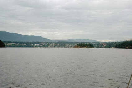
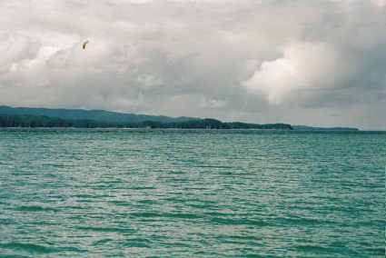
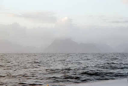
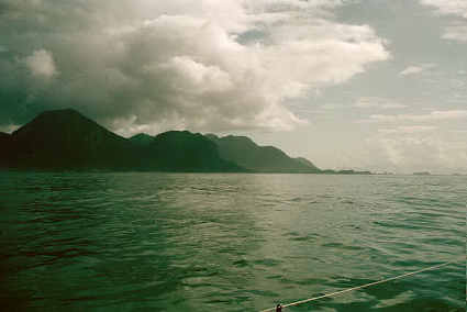
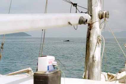
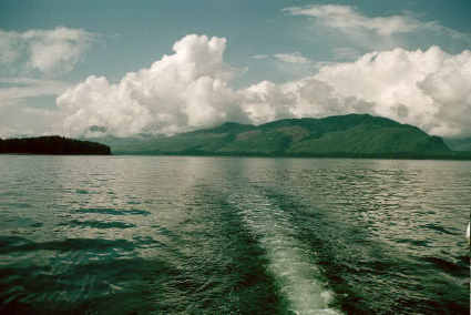
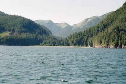
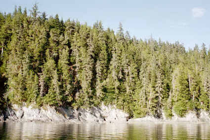
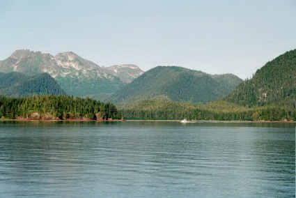
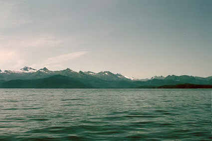
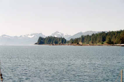
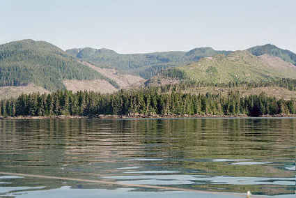
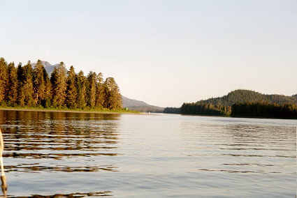
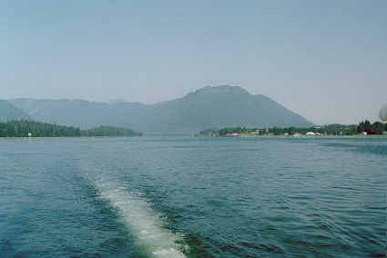
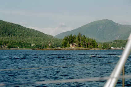
Photos
four
&
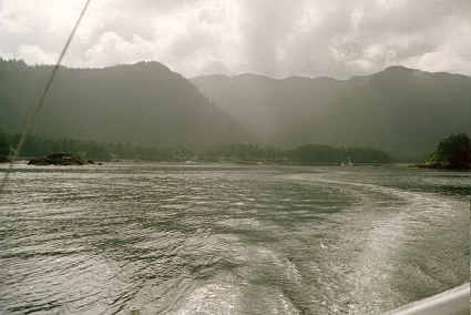
five:
mountains and valleys and fog in Land Locked Bay. Hoisted anchor
at 1515 and headed for Hinchenbrook Island. There was marginally
enough wind from marginally the right direction so I could use
the jib going across Port Fidalgo. Unfortunately when I got near
Goose Island it turned into a headwind so down it came. The rest
of the trip there were either light winds or headwinds. About
1800, as I was approaching Hinchenbrook Island it began to rain
again. As I got into Hinchenbrook entrance the swells picked up
to 6 feet, and I had to slow down to keep the motor from
overspeeding when it lifted out of the water. On top of that I
was fighting a pretty good current, so it was 2310 by the time I
dropped anchor in Garden Cove. When passing through the entrance
to the arm that leads up to Garden Cove, I saw a sailboat
anchored in a small alcove there. Kind of a nasty place to
anchor; he was really rocking due to the swell from the gulf.
________________________________________________________________________________
FRIDAY, 7/25/03: WAITING ON WEATHER
* Barometer 1007.5
* Wind E, 15 gusting to 25
* Rain
* 9-10
o C (48-50
o F)
* Cell phone 6+2 => 12 total
Spent the day reading. Kept the propane going to heat the
cabin…rather low, to keep the carbon monoxide down, but enough
to get the temperature up to 60. During the day several light
williwaws hit, concerning me about the possibility of dragging
anchor. In the later afternoon I decided to do something about
it, put on the survival suit (it was raining buckets), started
the motor and motored up at about a 30 degree angle to the
anchor and set a second anchor. I also stripped the deck of a
lot of the stuff (like the jib) that was catching the wind. This
all helped, but I was still veering around pretty badly. But
with 2 anchors set I felt fairly safe. I read until late in the
evening, well after dark, by using my flashlight.
________________________________________________________________________________
SATURDAY, 7/26/03: STAYING PUT
* Barometer 1005
* Wind E, 15
* Rain & fog
* 9-10
o C (48-50
o F)
* Cell phone 1+3 => 15 total
Another nasty day of wind and rain and fog. So I'm staying put.
Pretty much a repeat of the previous day; reading, cleaned up in
the evening. I ran the generator from 1900-2230, partly for the
light and partly for the heat--my 1500 watt heater fortunately
comes with two settings, a 600 (which the generator can run) and
a 900 (which the generator can't). Unfortunately there seemed to
be something wrong with the generator, and it really struggled
with even the 600 watt setting. I had to turn the heater off on
a regular basis. But at least I got some heat out of it.
________________________________________________________________________________
SUNDAY, 7/27/03: INTO THE PACIFIC OCEAN!
* Barometer 1007.5
* Wind E, 5
* Rain showers
* 9-10
o C (48-50
oF)
* Cell phone 1+2 => 18 total
I spent the morning doing those last minute chores I hadn't
gotten around to, preparing the boat for the ocean. The weather
looked good for the next 4 days, via the NOAA forecast.
Frankie's weather report looked good too (she was emailing me
weather from selected NOAA buoys, and giving me an idea of where
the lows were so I could time my departure between them). I
called her and told her I was off, and by 1045 I was--almost.
The anchors were really deeply imbedded in the mud. I finally
had to pull the danforth out by motoring ahead against it,
essentially pulling it up with the motor. They both got mud on
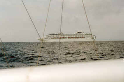
the deck *sigh*. It was a little after 11 by the time I left
Garden Cove. I spent the first half an hour stowing the anchors,
generator, etc. Off in the distance I saw a cruise ship exiting
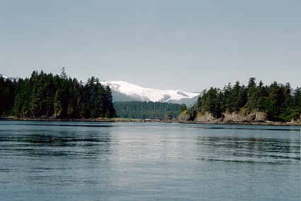
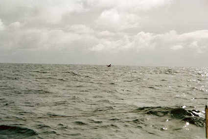
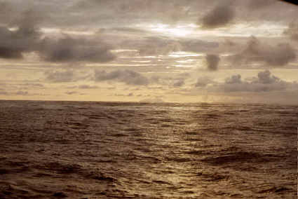
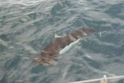
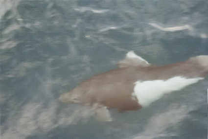
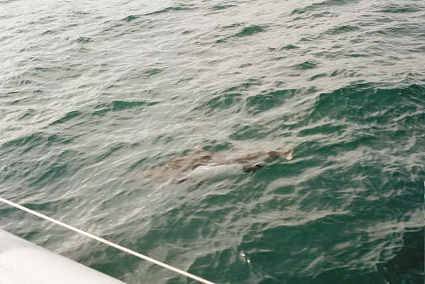
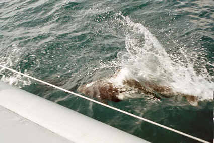
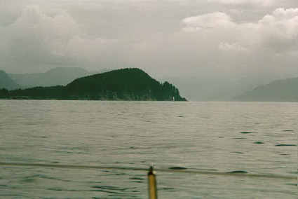
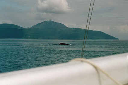
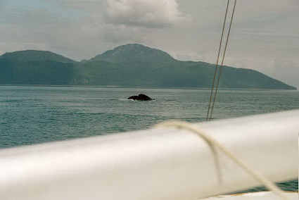
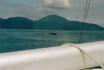
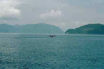
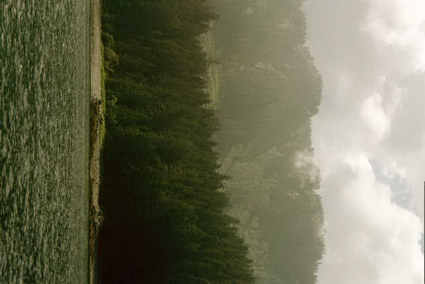
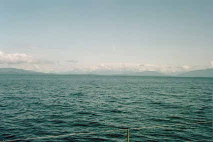
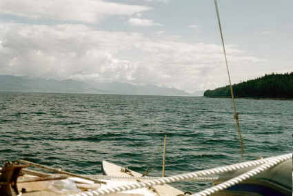
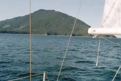
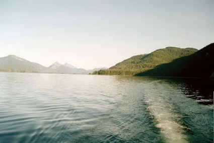
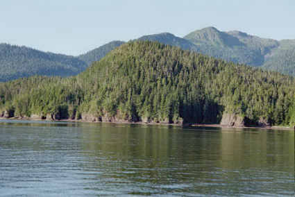
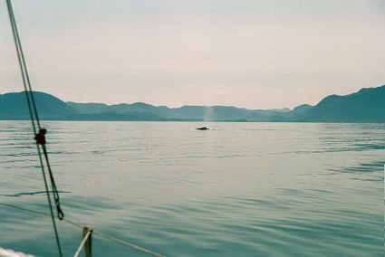
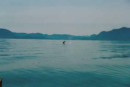
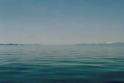
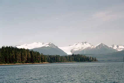
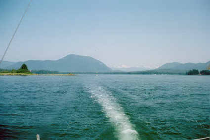
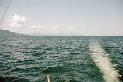
Prince William Sound--as I was soon to do myself. Photo
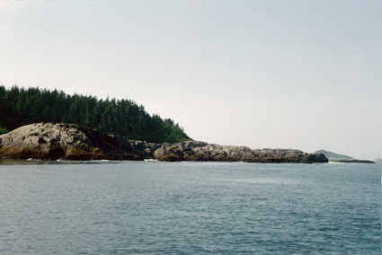
six: Porpoises
Rocks;
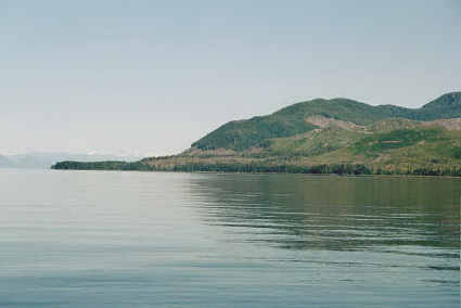
#7
looking back at Garden Cove; #8
Hinchenbrook Entrance.
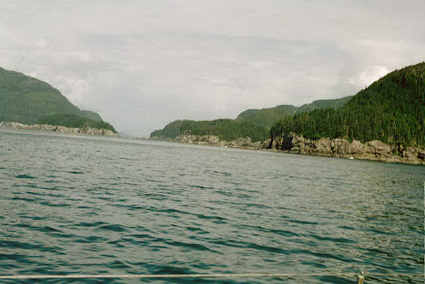
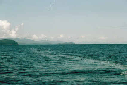
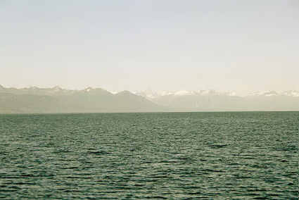
At 1215 I entered Hinchenbrook Entrance (the sailboat I'd
previously noted was gone), and had to slow down to 4 knots due
to waves lifting the motor out of the water (they were 4 feet
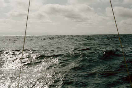
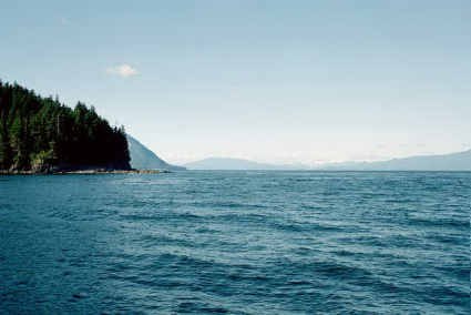
high, short and choppy). Photo 9 looking out into the North
Pacific past Hinchenbrook. 1330 cleared Hinchenbrook Entrance,
67.5 miles to Kayak Island! Pretty slow going due to the
confused (coming at me from several directions) 3' to 4' waves
though. During the afternoon I'd opened up the hatch to the
compartment below the steering, and the hatch cover hit directly
on the thermometer which I'd taped to the aft cabin. Of course
it broke it, so no more accurate temperatures. The wind came up
some in the mid afternoon, so I put up the jib, which increased
my speed to 5-6 knots and by 1800 I'd gone 20 miles in 5.5
hours. At 2030 I spotted Kayak Island through the mist, about 35
miles ahead. By 2100 the wind had died down to 5-10 and shifted
to SSE (had gotten up to 10-20) so I had to take the sails down.
2230 E wind at 10 and it started to rain. By 2300 the waves were
high enough so I had to slow the motor way down, and the wind
was strong enough (15?) so I wasn't making any headway. So I
laid the boat ahull and went to bed.
________________________________________________________________________________
MONDAY, 7/28/03: BLOWN BACKWARDS!
* Barometer 1008
* Wind E, to 35
* Pouring rain
* Waves to 9'
* Cell phone 21 => 39 total
By 3 am I had drifted significantly north toward shore so I
started the motor and motored south. The wind continued to
freshen until it was blowing 20 by 5 am. I decided not to fight
it any more and turned downwind, toward Hinchenbrook Entrance.
This proved an exciting ride, for the wind built up to as much
as 35 and the waves to 10'. (Note: the Cordova buoy, about 50
miles from my position, reported sustained winds of 33 with
gusts to 45.) It was pouring rain, which reduced the visibility
down under half a mile, occasionally under a quarter mile…so
navigation was strictly by GPS and compass. I continued
downwind, with just enough power to the motor to give me good
steerage. A few of the waves were steep enough so the boat began
to surf down them, which was a lot of fun. I was wearing the
survival suit, and so stayed plenty warm, but was not hungry
because of the violent motion…I made myself eat small amounts on
a regular basis anyhow (I wasn't seasick, just not hungry). By
the time I'd gotten back to Hinchenbrook Entrance the wind was
peaking. I could tell I was getting close to the entrance,
because I picked up a second pattern of waves, probably
reflecting off Hinchenbrook Island. When I got into the entrance
it got really wild, for the tide was flowing out and it made the
waves very short and steep. Still unable to see anything, so I
continued to rely on the GPS for my location, which I put as the
center of the entrance. I was pleased to observe another small
sailboat not far off, for that gave me a little more confidence
in my position--and a little while later the Statendam cruise
ship had to alter course to go around me (I couldn't see it
until too late). When I was even with Garden Cove at noon I
turned NE. Or tried to. The engine just wasn't strong enough to
fight the wind and waves. I put a serious effort into it, but it
was no go. Shortly after that the engine twisted funny, and when
I went to inspect it I found that whatever held the engine from
pivoting had loosened. This made the engine useless, for when
power was applied it just went sideways. About that time the
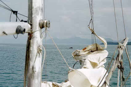
rain lifted enough so I could see--right down onto Montague
Island, 2 miles downwind. I quickly hoisted the storm jib and
continued on up into Prince William Sound. Once clear of the
traffic lane I took an hour nap and got something more to eat. I
then studied the map to find a place I could get out of the
wind, which wasn't blowing quite as hard--but still better than
20. Stockdale Harbor looked promising so I headed there. After
some tinkering and looking in the owner's manual (which showed a
lever for tightening the pivot--that didn't exist on my motor!)
I finally tied a couple of ropes to it that prevented it from
twisting. About the time I got it running I rounded the NE
corner of Montague Island, and the wind dropped way down so I
was glad I had figured out a solution. Stockdale Harbor turned
out to be a bit of a pain to get into, for there were outlying
rocks on the chart that didn't show above the water, so I had to
go almost 2 miles out of the way to be sure to avoid them. I was
a little concerned that the anchorage was exposed to the NW, but
it was calm in the end of the bay where I dropped anchor at
2030. During this whole time I'd been talking to Frankie on a
regular basis, reporting where I was and how I was making out.
As a consequence we used more cell phone time than the whole
rest of the time combined! In spite of that I wanted to chat a
bit to help unwind, so I called her at 2100 and we talked for 10
minutes. About the price of eating out… I made a good dinner
(canned stew) to offset all those calories burned but not
replaced during the struggle with the wind and waves, made some
quick notes in this log and went to bed.
________________________________________________________________________________
TUESDAY, 7/29/03: INTO THE PACIFIC OCEAN--AGAIN!
* Barometer 1012
* Wind E-S, 0-10
* Light showers
* Waves to 6'
* Cell phone 1 => 40 total
I slept in a bit and then spent an hour doing chores, working on
the motor, etc. After I talked to Frankie at 11 I got under way
by 1130. I transferred 40 gallons of fuel from the 55 gallon
drum in the bilge to my 5 gallon cans, so I could easily use it.
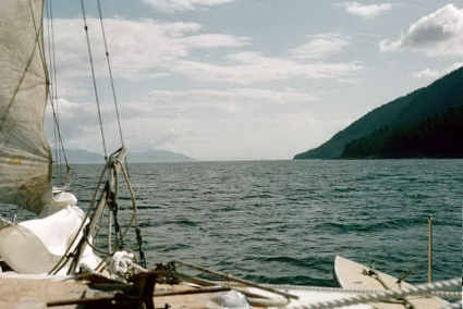
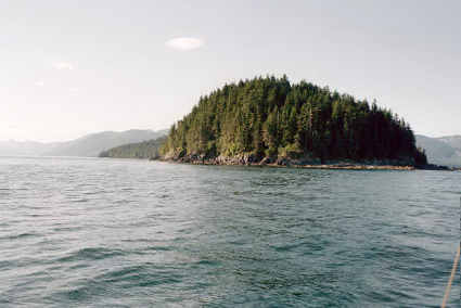
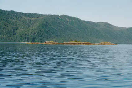
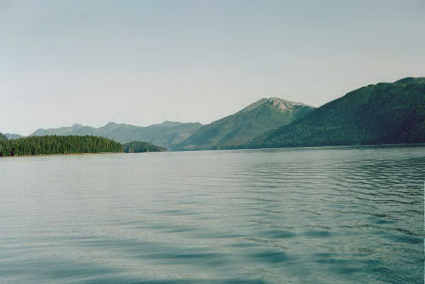
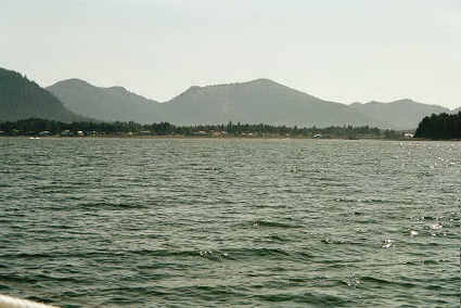
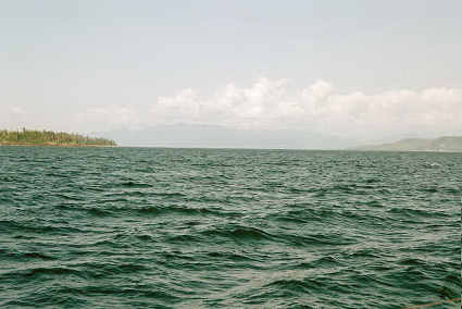
Photo 11:
Hinchenbrook
Entrance--from the west side! #12 of the NE end of
Montague Island. I
had been blown 30 miles up into Prince William Sound (for a
total loss of 67 miles!), so it was 1700 by the time I cleared
Hinchenbrook entrance again. Photo 18:
Hinchenbrook Island.
I was cruising between 4.5 and 5 knots, which was acceptable. At
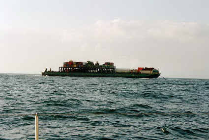
2100 I saw some whales breaching far ahead, and not too long
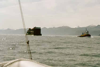
after that a tugboat came along towing a barge. He was the only
ship I'd seen so I turned on the radio to see if he might want
to say hello. I didn't call, just waited for him to call. Which
he did. Turned out to be the Ocean Ranger, headed for Whittier.
We chatted for just a few minutes and then signed off. At 2200
it started to rain again, and the wind picked up from the ESE at
9-10, reducing my speed to 3.9 knots. I kept pushing on…
________________________________________________________________________________
WEDNESDAY, 7/30/03: KAYAK ISLAND
* Barometer 1013.5
* Wind S, 0-10
* Rain-Sunny!
* Waves to 4'
* Cell phone 2 => 42 total
2400: rain. Ug. I pushed on. Eventually I sat at the navigator's
table, just inside the cabin, with ropes to the steering wheel.
With the compass just outside the door where I could see it
easily (though I did have to 'charge' up the luminescent spots
with the flashlight regularly), I could snooze for a few minutes
at a time. Every 15 minutes or so I'd stick my head out into the
wet and look around. About 0130 a fishing vessel passed me. Gosh
they sure have bright lights! I could see him long before he
came over the horizon. Half an hour later the motor started
kicking out so I laid the boat ahull and went to bed. This time
I am only 0.3 miles closer to Kayak Island than I was on Monday.
I lay down for 6 hours, getting a certain amount of sleep but
not as much as I would have liked. The motion and the noise
(mast wires and other things that were banging around due to the
rocking of the boat) tended to keep me awake. While I was
sleeping--or trying to--I drifted 2.8 miles north. 0900 Land Ho!
Kayak Island--again. Hope I make it around this time! There was
a little bit of wind from the S and SW at 0-7 mph, so as it
freshened I put the jib up--and as it faltered I took it down.
Not sure how much it helped, but perhaps a little. By noon I was
within 10 miles of Kayak Island, and my noon-noon distance was
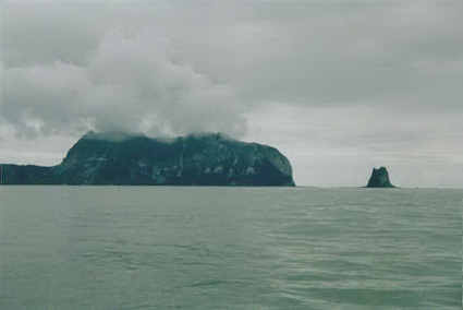
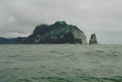
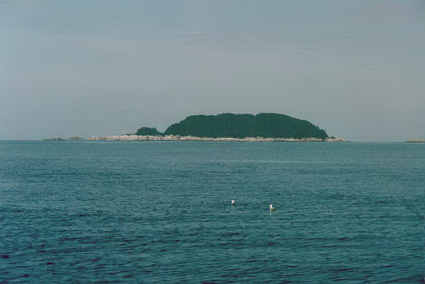
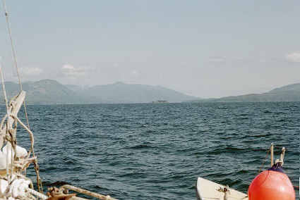
87 miles. Photo
14-
15 south end of
Kayak Island. I rounded the Island at 1345, 265 miles to Cape
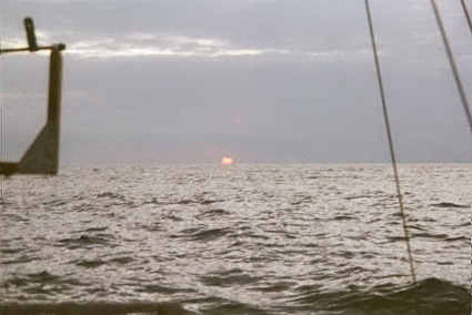
Spencer! At 1500 I was getting pretty groggy, and there was a
faint south wind so I put the jib up and lay down. By 1600 the
wind had quit and I was just bobbing. I got up at 1630, having
gotten a little bit of sleep, and some good rest. Still way
behind though--not used to sleeping in a bed that bounces,
shakes and rattles! Not to mention the waves slapping up against
the boat (which makes a lot more racket than you'd
think--especially with 3 hulls for them to slap!). Photo16:
sunset behind
Kayak Island. At 2230 the engine quit--I had forgotten to fill
the tank. After refilling the tank I set the jib, hoping to take
advantage of the 5 mph tailwind, lashed the wheel and went to
bed.
________________________________________________________________________________
THURSDAY, 7/31/03: CRUISING UNDER SAIL
* Barometer 1008.5
* Wind W, 10-12
* Sunny!
* Waves to 3'
* Cell phone 4+1 => 47 total
By 0300 the wind had freshened to 10, and the boat was no longer
taking care of herself so I took the sail down. First sail
change at night! The weather was looking much better than
earlier; there were even a few stars out. I went back for a
couple more hours of sleep, and got up at 0530 to a perfect
tailwind. I immediately set the jib. Only 226 miles to go to
Cape Spencer! I was still pretty groggy so I went back to bed.
The boat didn't point quite right (SSE instead of ESE), but at
least I was moving. By 0830 when I got up (well rested for a
change) we'd covered 5 miles so it was worth it. I set the
mizzen, which didn't gain me very much, and the storm jib
wing-in-wing with the jib. Which got the speed up to 4.2, which
is pretty good with only 10 mph of wind (so apparent wind speed
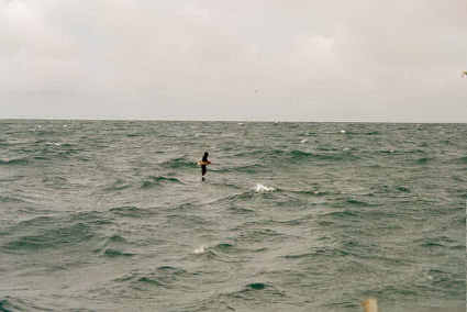
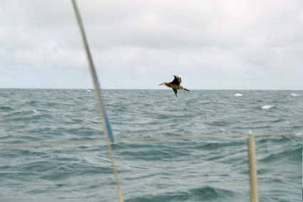
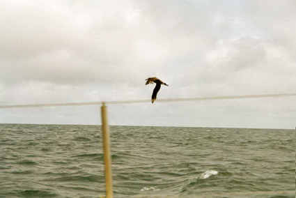
is under 6!). Lots of Fulmars (I think? Like a dark gull) and
albatross around. Photos
17,
18,
19 &
20 albatross.
Gosh both these birds are graceful. Especially the albatross.
They glide and glide, often with less than an inch clearance
between their wingtip and the wave. Never saw one make a mistake
and dip a tip though. Landing was done with exquisite grace by
the fulmars: they approach into the wind, slow down and then
with several light flicks of the ends of their wings bring their
speed down to zero and set down on the water. The albatross
aren't quite so good, but they are still very graceful about
landing. Taking off isn't as difficult as I had imagined it
would be for a bird that size (the albatross had 5-6'
wingspans!): they just head into the wind and run off the water
with considerably more grace than a duck. I think it would make
an interesting project to film albatross and study how they
interact with the wind over the waves so they can fly so
well--especially study how they can utilize the energy found in
vertical eddies which allow them to go and go without flapping
at all, just by soaring down below the wavetops! Noon--211 miles
to Cape Spencer. 64 miles covered noon-noon (spent too much time
sleeping last night!). At 1500 I decided to try for a nap
anyhow. Unfortunately I was unable to balance the sails so it
would self-steer. Everything I tried left it in irons. So I gave
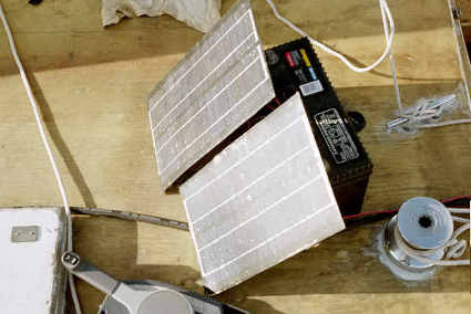
up on my nap. Photo
21-
GPS. Later that day it turned bright and sunny so I set up the
solar panels to recharge the old car battery, which is the one I
use for the radio and the navigation lights. Photo
22: sunny sea. The
wind started dying very slowly at 1500 and by 2200 my speed was
down to 2.5 knots. I'd been drifting very slowly south of course
over the day, which I didn't resist very hard since I wanted to
get out of the shipping lanes. So when I was ready for bed I
wouldn't have to worry so much about getting run down. Shortly
after 2200 I took down the mizzen and storm jib, hanked in the
jib tight and was still doing 1 knot so I set up the lights and
went to bed--47 miles covered under sail (hadn't started the
engine all day). What a great day--if this is what it is like to
sail down the tradewinds I can't wait!
________________________________________________________________________________
FRIDAY, 8/1/03: A GREAT AND LONELY OCEAN
* Barometer 1006
* Wind W, 6-7 * Sunny-cloudy
* Waves to 3'
* Cell phone 8 => 55 total
I couldn't sleep and couldn't sleep so at 0300 I move to the
floor, which was a great deal more steady than the bunk (which
went up and down a lot as the waves passed under the outrigger).
I finally go some sleep, and slept in until 0800. Over the night
we'd sailed 16 miles. In approximately the right direction;
there is only 165 miles left to Cape Spencer (when I went to bed
it was 179). This is half way! I got under way by 0830. There
was still a west wind blowing, but it was so faint (5-7) that I
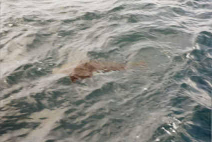
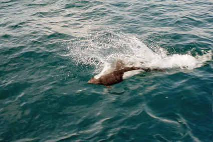
was going nearly as fast as it most of the time. A pair of
porpoises came by to check me out. They must have been the
leaders of a few others, for 5 minutes later 4-5 more showed up.
They played around the boat for an hour and a half, while I took
a bunch of photos hoping a few will turn out (photos
23-
24; and an entire
roll of which shot
#3,
#8,
#10, (
11 &
16 only because
it shows how close to the boat they were),
#14,
#20 and
#24 are worth
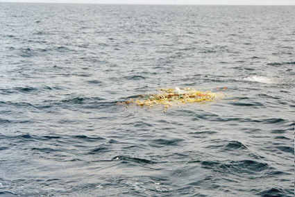
viewing). A little later I passed a
tangle of
fishnet and line: photo 1. At noon I was 145 miles from Cape
Spencer, giving me a noon-noon distance of 66 miles. The wind
was still steady from the west, and so faint as to be useless. I
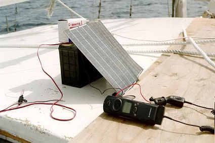
set up the solar panels and connected them to the battery, and
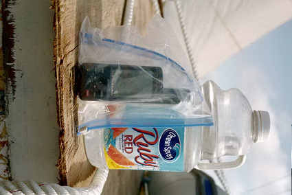
then spent a couple of hours charging up the cell phone battery.
Photo 2:
charging
the cell phone. Photo
#3,
#4,
#5 albatross taking
off. In the early afternoon I decided I was going to be lazy
about transferring fuel; rather than pump it from the larger
containers I'd connect two pieces of fuel line together and put
the end directly into the 35 gallon drum. After 4 tries I gave
up; either the fuel pump on the engine wasn't up to it or the
hose-hose connection was leaking air. So I siphoned the gas into
5 gallon containers instead, and transferred the gas that way.
About 1600 the wind dropped and shifted south. By 1900 it was
only blowing about 4, but I could still use the sails with some
effect. I celebrated being past half way by making a crude tuna
fish casserole (from macaroni, cheese, tuna, and a can of mixed
vegetables). It turned out quite good. I was hoping to arrive at
Cross Sound (Cape Spencer) by dark the next night so I pushed on
well after dark, getting to within 80 miles. While steering, I
read by the light of the LED navigation light, pulling the
battery/light setup back far enough so it shone on my book. At
2330 I shut off the motor and took down the mizzen, but left the
jib up hoping to gain a few miles. .
________________________________________________________________________________
SATURDAY, 8/2/03: I ARRIVE--WELL, SORT OF
* Barometer 1005
* Wind light and variable
* Sunny-cloudy
* Waves to 4'
* Cell phone 6 => 61 total
At 1 am when I got up to check everything I found the jib moving
me N towards the shipping lanes. So I doused it and went back to
bed. It was another uncomfortable night, bouncing around, so I
moved to the floor again which helped a lot. I got up at 7 and,
intent on making landfall, I was under way by 0715. There was
still a very light air from the south, so I put up the mizzen
(there wasn't enough wind for the jib). Unfortunately by 0830
the wind had died and (even worse) by 0930 was blowing from the
E at 5. Ever since the electrical failed on the motor the
battery I'd been using to start it hadn't been charged. Since it
was a nice sunny day I decided to hook up the solar panels and
at least give it a little charge--though at 1.2 amps it would
take a long, long time to fully charge a 105 amp-hour battery!
But at least I'd give it a bit of a boost. Though it was still
holding up very well; it started the motor very easily with no
sign of voltage drop. My best noon-noon day: 94 miles. Only 51
miles left to Cape Spencer; hope I can make it by dark!
Unfortunately by 1330 I decided it wasn't feasible--especially
since it was 10 miles past Cape Spencer before I'd find a good
place to anchor. A look at the map presented a solution: Graves
Harbor, just up the coast from the cape, was about 3 miles
closer. So I altered course to there. At 1345 I passed what may
have been a weather buoy at 58
o 16.3 N and 137
o58.9W
(I
recorded
the location so I can see if that really was one!) I thought it
was a ship at first, or I would have gone over to check it out a
little closer. I've seen them in photos, but it would be neat to
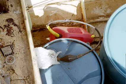
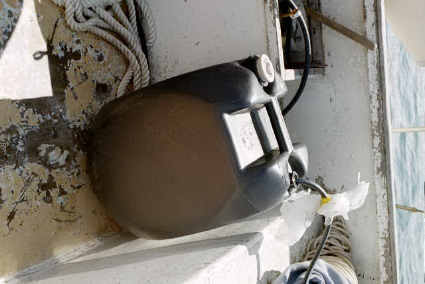
take a look at one in person. Photo 6: fuel
siphon/pump
(100 squeezes/gallon! *almost* not worth it). 1530 Land Ho! Top
of mountain 45
o to port. The Alaskan coastline is
angling south to meet me. Still nothing dead ahead, and only 30
miles to go. There is too much haze. I took a photo of the
mountain anyhow, though I've doubts it will show anything (it
didn't).
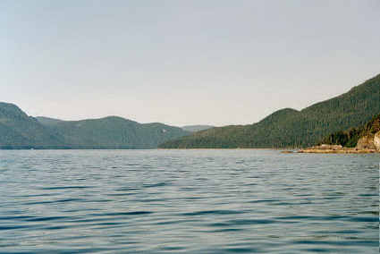
1630--finally! Cape Spencer, 26 miles away. At 1700 the wind
began to die away, and as it did my speed began creeping back up
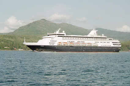
from 4.5 to 5. Photo 8:
cruise ship
that passed about 1830. Photo 9: charging the
battery. At
1915 the Ocean Ranger passed again, this time on his way south!
I spoke with him briefly, asked when he would arrive in Seattle
(8/7), and he said we'd probably meet again. Photo 10:
barge pulled
by Ocean Ranger. Photo 11:
Astrolobe Point.
#12
setting sun.
I got the anchor down at 2215. I cleaned up the boat a bit
(mostly charts and stuff I'd been reading) and then made grilled
cheese and onion sandwiches to celebrate arrival. My first ocean
crossing! Not that it was that far; but a step in the right
direction… I'd been using the anchor lamp to help light the
cabin, so when I was done eating I shut off the propane and hung
it out. This is a popular spot for fishermen; as I was headed to
bed a second fishing boat arrived.
________________________________________________________________________________
SUNDAY, 8/3/03: CAPE SPENCER AT LAST!
* Barometer 1009
* Wind calm
* Sunny
* Waves to 3'
* Cell phone 2 => 63 total
I slept in, but did get up in time to get the last of the fuel
transferred into 5 gallon cans (by pump this time) before
calling Frankie at 10. There is 22 gallons of fuel left; enough
to get to Hoonah with 7 gallons to spare--if I only get 4
mpg. So I decided to skip the alternative fueling places.
By 1015 I was under way, motoring out of Murphy Cove (on the
south side of Graves Harbor) where I'd spent the night. Photo
13:
Libby Island,
at the entrance to Graves Harbor; #14: looking back at
Murphy Cove
#15
rocks by
the entrance to Murphy Cove--stripped of their vegetation 30
feet up: it must really get pounded here in the winter! #16
Cape Spencer!
#17:
Hole in
George Island. #18
Inian Island.
Going up through south Inian Passage I got a tremendous boost
from the tidal currents; the GPS said I was doing 9 knots for a
little way! Photo
19,
20,
21,
22,
23 and (best)
24 whales.
There were a lot of whales out in the first part of Icy Strait.
I arrived at Gull Cove at 1435. There wasn't another good place
to stop before Hoonah, and it was a little far to get there so I
stopped. There were some cabins there, hope they don't mind
sharing! I spent the afternoon reading (still getting over the
ocean voyage), and the evening I ran the generator so I could
get the logbook put into the computer (made some progress, but
still have a long way to go). Then I read by flashlight.
________________________________________________________________________________
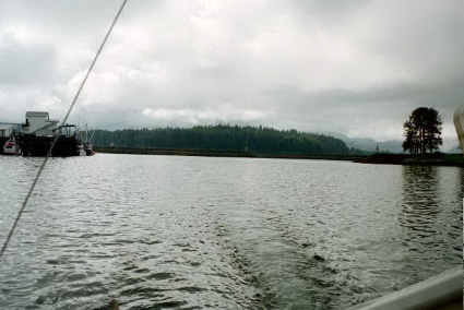
MONDAY, 8/4/03: HOONAH!
* Barometer 1004
* Wind calm
* Cloudy-rain
* Waves to 1'
* Cell phone 0 => 63 total
Shortly after I got up I heard a booming noise that sounded like
shotgun blasts in the distance and was puzzled as to what it
could be until I saw, about 2-3 miles away, whales breaching.
Wow! Wish I could get close enough for a photo! One got
completely out of the water. I didn't get a very early
start--but even so I started too early because I was fighting a
1.5 knot tide. But, by early afternoon, it had turned and was
pushing me about that so it all evened out. My goal for the day
was Hoonah, a small village just off Icy Strait. It rained off
and on during the 6 hour motor there, a cold, cold rain (Icy
Strait is well named?). So I was very happy to arrive. As I
approached I was puzzled by their harbor entrance, until I got
close enough so the reversed position of their red & green
markers turned the right way--it was just the angle I was
looking at that made it confusing. I pulled into their transient
dock, which is just inside the breakwater, tied up and went up
to the harbor master's. Very reasonable for a night's stay: $14.
I asked about restaurants, and then hiked through town to where
the fuel dock was to check on prices ($2/gallon). First time in
nearly two weeks I'd been off the boat--felt good tow walk
around! While I was at it I checked out the grocery store. I
found a small but well stocked store…with very high prices ($5
for a 10 pound bag of flour, $6 for a box of cereal). Glad I
don't need any food! Fortunately the restaurant was a little
more reasonable; I got a superb hamburger with a salad for less
than $10. By the time I was done with dinner it was almost time
for my 1800 schedule with Frankie, so I walked back to the
harbormaster's (where there was a pay phone) and called her. It
was sure nice to talk without having to worry about paying
nearly $2/minute! On my calling card we could talk for an hour
for the price of a single minute on the satellite cell phone. Of
course, what you are paying for is access--it sure was nice to
have a friendly voice to talk to when being pounded by 45 knot
gusts in the North Pacific! I was still hungry after talking
with Frankie, so I walked back to the Deli and bought an ice
cream cone ($2.75) for desert before going back to the boat. The
harbormaster was walking the docks, and suggested I move to the
other side of the transient slip so people would have more room
to get by (one of the problems of having a 22' wide boat!) She
gave me a hand doing so, which was very nice of her. I took it
pretty slow and easy, for I am still not very confident of
either the motor (don't want it to stall when I need it to stop,
so I go slow so I won't have to use it to stop) or my ability to
make the boat do what I want (sure be glad to get the inboard
put in!). But it worked out very well… I hauled my garbage up
the hill (2nd five gallon bucket), got caught up on this (the
hand written part, not getting it into the computer) and then
spent the rest of the evening reading by candle light.
________________________________________________________________________________
TUESDAY, 8/5/03: CHATHAM STRAIT
* Barometer 1008
* Wind light and variable to north at 12
* Cloudy-sunny
* Waves to 1'
* Cell phone 0 => 63 total
First thing in the morning I ran out of my first 5 gallon bucket
of wash/cooking water. Not bad--5 gallons lasted me 2 weeks! I
hadn't liked the taste (at the restaurant) of the water here so
I used the other 5 gallons I had with me. After a leisurely
breakfast I walked up to the harbor masters and called Frankie.
When I got back to the boat I untied and motored out of the
harbor to the fuel pier. It was quite a climb up, and then back
down, and then back up again…but good exercise. The guys working
there were fascinated with the Acrux and one went down the 25'
ladder to take a look at it. After getting 63 gallons of fuel (I
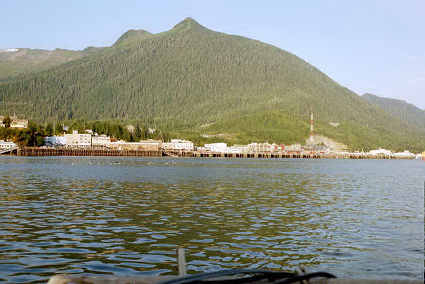
didn't fill the 55 gallon drum) I headed out. Photos
#1,
#2, &
#3 are of
Hoonah as I left. Although there was a north breeze blowing in
Port Frederick (where Hoonah is), by the time I got to Icy
Strait it had quit. Photo 4, looking back at
Port Frederick.
The sun came out by the time I got to Icy Strait and by the time
I was headed east it had turned into a gorgeous day. Photo 5:
mountain & fog on
Point Sophia.
Photo 6: looking west down
Icy Strait.
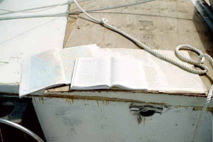
Photo 7:
maps,
charts and Coastal Pilot, all laid out handy to use. Photo
8: looking north across
Icy Strait,
Chatham Strait on the right. At 1330 the engine quit. Twice.
Water in the fuel. Sure am glad I have a good fuel filter! All I
had to do was drain it from the filter and start the engine back
up. I tipped the gas can and pulled the hose up a bit so it
wouldn't pick up any more water (
photo 9); I
won't be able to clean the gas can out until I have burned about
20 gallons--the 15 in the gas can, and another 5 gallons so I'd
have something to dump the left over fuel and water into. At
1500 I could see past Point Augusta into south Chatham Strait.
Photo
10
&
11
Chatham Strait. #12 looking NNW at
False Bay--looks
like a nice beach. Protected only from the N to SSW wind though.
After rounding Point Augusta the wind picked up from the north
at 10-12, so I put up the jib and mizzen. Photo 13,
beach just
north of Flints Point. #14
North Passage
Point, looking NW; #15
North Passage
Point and Chatham Strait looking north; #16 side of
North Passage
Point, looking north; #17
jellyfish
that looked like it had blood in it. About 1730 I turned the
corner of North Passage Point and followed the shore to a small,
spectacular cove at the end of the peninsula. I had planned on
anchoring in Pavlof Harbor, across Freshwater Bay from this
cove, but the wind was blowing directly into the harbor. This
cove is well protected from west through north east, so I hope
the wind doesn't decide to blow from the south or south-east! If
the wind starts blowing from that direction I'll have to leave.
I dropped anchor by 1800, read for awhile and took a short nap.
I'd been getting concerned that the battery I'd been using to
start the motor with was getting low, for the only charge was
that little bit with the solar panels (after all it had been
starting the motor--several times a day--for two weeks now), so
I rigged up some wires to the generator and charged it for half
an hour. While it was charging I worked on entering this logbook
into the computer, and then kept on working on this until the
generator ran low on fuel. I didn't want the generator to quit
while I had the computer on, so I shut it down and read until it
died. Then I did a final check of the boat, and noted the moon
was reflecting off the water so I thought I'd try a couple of
shots: #18 at 1/15th of a second and #19 at 1/8th. Neither
of these shots worked, so the numbers were dropped.
________________________________________________________________________________
WEDNESDAY, 8/6/03: MURDER! COVE, THAT IS.
* Barometer 1008.5
* Wind north to 12
* Cloudless and Sunny
* Waves to 1'
* Cell phone 4 => 67 total
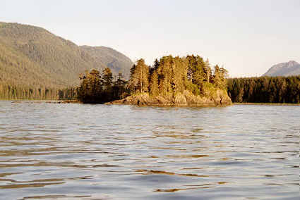
I was up fairly early, for I wanted to make it to Warm Springs
Bay by dinnertime. Photo 20 -
cove where
I'd spent the night. Photo 21:
Heide Rock,
just off the cove. This area was well protected from tidal
currents so I tested to see how fast I was going: 6 knots. Photo
22:
Pavlof
Harbor; #23 just
SE of Pavlof
Harbor; #24 end of
Freshwater bay.
Photo 1:
Tenekee
Inlet. By 0900 there was a 10 mph north wind, so I set the
jib. Then I spent an hour getting the main up for the first
time. It took that long because I had to get the halyard down,
tie an extra rope to the end of it for it had been cut off
short, and then (because the pulley at the top that the halyard
wire ran across was chipped and I didn't trust it to let the
sail down again) rig up a pulley with a rope that I then pulled
up with the old halyard. Then I used this pulley and rope to
pull the main up with. Because this was the old main sail, which
had blown out the bottom the last time I used it (the new main
sail arrived in Seattle--2 days after I left Fairbanks!) I tied
it so that it was loose-footed. It worked fairly well, and when
I called Frankie at 10 I was able to boast of having all the
sails set. 1115 I passed Angoon on the far shore. 1200 passing
Peril Strait, which I would have come down if winds had blown me
south to Sitka. The wind is dying away; down to only 7-8, just
barely enough to fill the sails. 1230…all sails down. Photo 2:
tugboat
and barge. 1330 passing south end of Catherine Island, and
the start of
Baranof
Island (photo 3) in the background. #4 southern most
tip of
Admirality Island at 1630…farther than I intended on
going, but that tailwind really pushed me along, and I'm sure I
had a trailing tidal current most of the day. By 1800 I had the
anchor down, after a false start due to the murky water (the
first attempt the water was only 8 feet deep…with a couple of
hours to high tide, this wasn't enough to keep me afloat when
the tide went out!) Photo 5:
Murder Cove.
Gosh what a lot of horseflies there are around! The old car
battery I'd been using for navigation lights was too weak to run
the inverter for the computer, but when I hooked up the solar
panels to it that gave it just enough. I used the computer like
that for an hour, until the inverter squawked from lack of power
as the sun went down. Then I started the generator and kept
working until 10 and bed.
________________________________________________________________________________
THURSDAY, 8/7/03: DOWN FREDERICK SOUND
* Barometer 1009.5
* Wind...none
* Cloudless and Sunny
* Waves to 0'
* Cell phone 4 => 71 total
Wups! Well I've done that before. Embarrassing though: went
aground at 3 am when the tide went out. The boat got a good tilt
to it, and went crunch, crunch as it ground down into shells on
the bottom. By 5 am I was floating again, and slept in a bit to
make up for the missed sleep. I did manage to get out of bed in
time to call Frankie at 10, and then got under way. Photo
#6 &
#7 of
Bartlett point with Baranof Island in the background. As I came
out of the cove I felt like I was surrounded by whales: some
coming up half a mile to either side and more breaching to the
east and more to the south, though none were very close they
were in all directions. Wish I had a good telephoto; all I've
got is 85 mm and that isn't enough to take pictures at this
range. I tried anyhow: photos 8-14...only
#13 and
#14
were much good. I finally had burned enough fuel so I could
clean out the tank. I dumped the few remaining gallons into the
empty 5 gallon can and then refilled the 15 gallon gas tank from
5 gallon cans. I poured the gas through a shammy cloth to take
out the water, and a good thing I did to: I got another 3 cups
of water. Turned out I didn't get it all though: the engine quit
3 times before I finally tipped the jug and pulled the hose out
a bit. Guess they sold me some bad gas! This filter sure is
nice… The bulk of the day was motoring across a glassy Frederick
Sound. I spent the time reading, for the going was dead simple.
Almost no other boats around, even, though I did see the State
Ferry and a couple of fishing boats. 5 twin engine airplanes,
all in a row, flew over; looked like they were going from Sitka
to Petersburg. Photo
15-
16 north
end (Pinta Point) of Kupreanof Island. Photo 17:
Stephens
Passage, looking due north. #18 looking east down
Frederick
Sound at Kates Needle. Wow, what a peak. Over 10,000 feet
high, and the last 5,000 feet go up at more than 60
o!
I fought the tide, with a ground speed of 4.5, until 1700 when
it changed and boosted me along at 7 knots. Unfortunately I only
went for 3 more hours, dropping the anchor in Portage Bay at
2000. There is a good tidal rip going into the Bay; hope I can
get out in the morning! Photo 19
Portage
Island, just off Portage Bay (
photo 20).
The Coastal Pilot recommended anchoring in the middle of the
(3/4 mile wide) bay, so as soon as my lead line got under 40' I
tossed out the anchor. The rest of the evening I spent with the
generator running, working on getting the logbook all caught up
in the computer.
________________________________________________________________________________
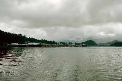
FRIDAY, 8/8/03: PETERSBURG!
* Barometer 1009
* Win N at.0-10
* Cloudless and Sunny
* Waves to 1'
* Cell phone 0 => 71 total
I was in no hurry to get under way; I planned to spend the night
in Petersburg, which was only a 6 hour trip. When I did get
ready around 11 I had to get the anchor out. First I went to
start the motor--and found kelp tangled around the rudder. I
cleared it and was very glad I had, for there was some line
tangled in the kelp--the motor probably would have cut the kelp,
but the line would have made a mess. Once all that was clear I
motored ahead a bit to take the tension off the anchor rode
(there was a 10 knot wind blowing, and I'd anchored in 30 feet
of water so had out all 200 feet of anchor rope). Then I went to
pull in the anchor. And the rope wouldn't come. After struggling
to get in ten feet I found a huge ball of kelp wrapped around
the rope and had to cut it off (reached down with a long pole,
hooked some kelp, pulled it up, cut it off…repeat until done).
Finally by 1140 I was under way. It was another gorgeous day,
and for a good bit of the way I had a nice tailwind--enough to
sail about half the time. Photo 21:
Point
Straight
and the NE corner of Kupreanof Island. The tide was
pushing me part of the time too, so I made very good time, up to
7 knots. Photo 22:
Sukoi Islets,
just before Wrangell Narrows. #23:
North
entrance to Wrangell Narrows and Petersburg. When I
arrived in Petersburg I tied to the end of a handy dock and went
up to the harbormasters office and he assigned me a (double)
slip for $15. I moved the boat and then went for a walk through
the waterfront part of town. I called Frankie at 6 (nice to be
able to talk without having to worry about that $1.75/minute
cost for the satellite link!), bought $15 in groceries (well, $8
of that was a book) and then walked back to the boat. I had a
leisurely dinner before spending a quiet evening reading (by
candlelight after dark).
________________________________________________________________________________
SATURDAY, 8/9/03: WRANGELL NARROWS TO SUMNER STRAIT TO SNOW
PASSAGE, DOWN CLARENCE STRAIT *WHEW*
* Barometer 1008.5
* Wind NE-NW at.0-12
* Cloudless and Sunny
* Waves to 2'
* Cell phone 0 => 71 total
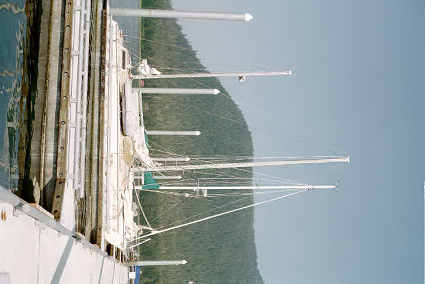
Photo 24 Acrux
moored in
Petersburg. First thing in the morning I hiked up to the
hardware store and bought 3 maps for $56. Then I stopped in at
another store and bought a pump so I could pump the oil out of
the top of the motor instead of having to drain it $28. Then I
tried to call Frankie but the call didn't go through. So I hiked
back toward the boat and, at the phone near the top of my ramp,
tried again. This time I got her and we chatted for a bit before
I headed on down to the boat. I untied, motored over to the fuel
dock, where I had to wait in line for 15 minutes--fighting the
currents while I did so, which wasn't very easy. It took 40
gallons to fill all the jugs I'd used since Hoonah. Price was a
little cheaper, so it only cost me $74. I'd wanted to leave by
10 to take advantage of the 2 knot tide flowing south through
the Wrangell Narrows then, but it was 11 by the time I got under
way. Photo 1:
south
Petersburg, looking north from the Wrangell Narrows. #2
Wrangell
Narrows, looking NE from about halfway down. Fortunately
my time turned out to be better than I thought, for I hit the
middle of the narrows about the top of the tide; there was about
15 minutes of slack tide and then it started pushing me south
again. I don't know how they manage towing barges and big ships
through those narrows; not a job I'd want! It really looks too
narrow for them. Fortunately none came alone while I was in the
narrows, but I did see a couple exit while I was sailing across
Sumner Strait. It was very hazy all day, and in the afternoon I
thought I smelled a bit of smoke. As the sun went down the haze
looked redish, so I suspect there is a forest fire somewhere
that is really putting out a lot of smoke! Not too long after I
got out into Sumner Strait a NE wind picked up. It was only
blowing about 5-6, but that was enough to make it worth putting
up some sails since it was nearly across my course. With all
sails up it pushed me along an extra knot or so. Photo #3:
Zarembo
Island. I cross Sumner Strait, went through Snow Passage
and into the north end of Clarence Strait. There was a
little bit of wind, so I had the sails (
photo #5)
up part of the time. I had picked two possible places to spend
the night, Coffman Cove and, 12 miles further, Ratz Harbor. Both
of these were on Prince of Wales Island, a place I have been
intrigued with since I nearly bought some land in Thorne Bay
15-20 years ago (unfortunately Thorne Bay was too far to make
tonight). Without the wind I would have had no chance of making
Ratz Harbor. But I was doing 6 knots when I passed Coffman Cove
at 1900, and figured I'd have just enough time to get the anchor
down in Ratz harbor by 2100. So I pushed on. The sun set at
2045, a little sooner than I'd planned, and it got dark
relatively quickly so I was glad to get the anchor down at 2115.
This small harbor (about the size of the south arm of Sawmill
Bay in Valdez Arm, for those of you who know that one) had
another sailboat and two fishing boats in it when I arrived.
Within the next couple of hours 4 more fishing boats showed up
(I can see why they put a light at the entrance!) and made the
place very crowded with 8 of us anchored in that small harbor. I
imagine I'll have to get used to it though; the farther south
the more populated it is likely to get. I spent the evening
reading by candlelight--listening to the boats drop their
anchors as they found a spot.
________________________________________________________________________________
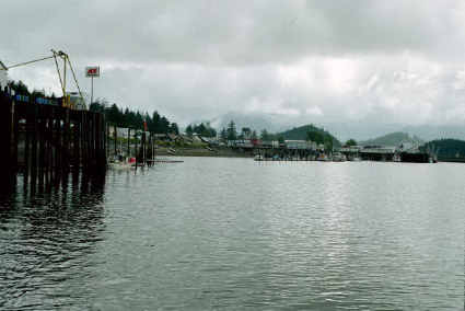
SUNDAY, 8/10/03: KETCHIKAN!
* Barometer 1009.5
* Wind S at.10-12
* Cloudy to Sunny
* Waves to 2.5'
* Cell phone 0 => 71 total
I was not very comfortable with where I was anchored (deep water
so my scope was poor, close to an unknown shore which could have
outlying rocks) so I got up every couple of hours to check and
make sure I wasn't dragging the anchor. So I didn't get a very
early start. Then I was fighting a headwind and modest waves, so
the going wasn't very fast. It had started out cloudy, but
turned into a nice day. As usual I spent the day reading and
steering, with quick dashes below to make lunch, use the head,
etc. Photo 6: entrance to
Thorne Bay.
#7 looking N on
Clarence
Strait, Thorne Bay to the left. #8
Caamano Point
and Behm Canal. #9
Guard Island
and the entrance to the Tongass Narrows to Ketchikan. #10
Ryndam
exiting the Tongass Narrows, northbound. #12 house on
Danger Island.
#13
downtown
Ketchikan. I arrived in Ketchikan about 1830 and called
the harbormaster. No answer. So I cruised by the first marina
(Bar Point Basin) real slow. I didn't see anywhere I could tie
up, so I tried the harbormaster again. Still not in. So I
cruised on down to the second marina (Thomas Basin, 1.5 miles
further on) and cruised by it. That looked even worse. So I
tried the harbormaster again. This time he came back, and I
asked for a slip. He asked me to hold on. After holding on for
half an hour (while I slowly motored back to Bar Point Basin) I
called again. He had found a place for me to berth, and by the
time I was tied down it was nearly 2000. I walked up the hill to
the harbormaster's to check out the phone, shower, garbage and
water facilities. Then I had dinner before my 2100 appointment
to talk to Frankie. After a nice long chat with her and Mom, I
called Matt and talked with him for awhile before I headed back
to the boat to read that McCaffrey book I'd bought in
Petersburg…by candlelight, as usual.
________________________________________________________________________________
© by Ray R. Collins
The current copyright laws protect this page, even though
it is not specifically copyrighted.
Please respect my work, and if you quote any portion
please ask for permission unless it is a very short quote
with references.
Back
to the Sailing to Seattle main page.